Geolocate

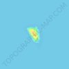
Lagunde topographic map

Click on the map to display elevation.

About this map

Name: Lagunde topographic map, elevation, terrain.

Location: Lagunde, Oslob, Cebu, Central Visayas, 6025, Philippines (9.51259 123.42101 9.55259 123.46101)

Average elevation: 48 m

Minimum elevation: 0 m

Maximum elevation: 456 m

Other topographic maps

Click on a map to view its topography, its elevation and its terrain.

Lagnasan River

Philippines > Cebu > Oslob > Manlum

Average elevation: 533 m

Sumilon Island

Philippines > Cebu > Oslob

Average elevation: 0 m

Gear up for your next adventure:

👟Leg Gaiters - Keep debris, mud, and snow out of your boots
🌡️Emergency Mylar Blankets - Compact thermal protection for unexpected nights outdoors
🔥Emergency Fire Starter - Reliable ignition source for all weather conditions
🧥Softshell Jacket - Windproof and breathable jacket for hiking
🥾Waterproof Trail Shoes - Shoes designed to handle wet terrain

As an Amazon Associate, this site earns from qualifying purchases at no extra cost to you.