Geolocate

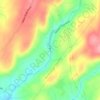
Sumneytown topographic map

Click on the map to display elevation.

About this map

Name: Sumneytown topographic map, elevation, terrain.

Location: Sumneytown, Marlborough Township, Montgomery County, Pennsylvania, 18084, United States (40.30899 -75.47101 40.34899 -75.43101)

Average elevation: 106 m

Minimum elevation: 42 m

Maximum elevation: 164 m

Other topographic maps

Click on a map to view its topography, its elevation and its terrain.
Gear up for your next adventure:

🛌Down Sleeping Bag - Superior warmth-to-weight ratio for cold nights
🥾Trail Hiking Shoes - Durable shoes designed for rugged trails
🌡️Emergency Mylar Blankets - Compact thermal protection for unexpected nights outdoors
🪜Heavy Duty Carabiners - Multi-use clips for securing gear to your backpack
🧳Compression Sacks - Maximize space in your backpack by shrinking gear

As an Amazon Associate, this site earns from qualifying purchases at no extra cost to you.