Geolocate

Garita topographic map

Click on the map to display elevation.

About this map

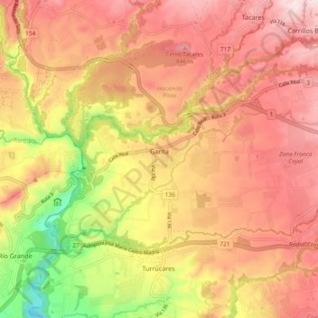
Name: Garita topographic map, elevation, terrain.

Location: Garita, Cantón Alajuela, Alajuela Province, 20113, Costa Rica (9.96384 -84.35211 10.01560 -84.26010)

Average elevation: 672 m

Minimum elevation: 348 m

Maximum elevation: 884 m

Gear up for your next adventure:

Camping Groundsheet - Protect your tent from moisture and dirt
Backpacking Tent - Lightweight tent for long-distance hiking trips
👟Sport Hiking Sandals - Breathable footwear for water crossings and camp rest
🔋Emergency Crank Radio - Weather alerts and power without needing batteries
🥾Lightweight Hiking Boots - Boots for comfort and mobility on long hikes

As an Amazon Associate, this site earns from qualifying purchases at no extra cost to you.