Geolocate

Leeds topographic map

Click on the map to display elevation.

About this map

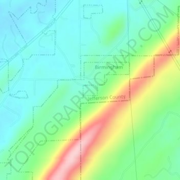
Name: Leeds topographic map, elevation, terrain.

Location: Leeds, Jefferson County, Alabama, United States (33.49731 -86.58651 33.49889 -86.58395)

Average elevation: 237 m

Minimum elevation: 175 m

Maximum elevation: 378 m

Gear up for your next adventure:

🔨Vehicle Emergency Tool - Safety tool for remote road trips to trailheads
Backpacking Tent - Lightweight tent for long-distance hiking trips
🦶Anti-Blister Balm - Prevents friction and hotspots during long ascents
🔪Outdoor Multitool - Versatile tool for repairs and food prep in the wild
🧢Sun Protection Cap - Breathable cap to protect from sun exposure

As an Amazon Associate, this site earns from qualifying purchases at no extra cost to you.