Geolocate

Cojitambo topographic map

Click on the map to display elevation.

About this map

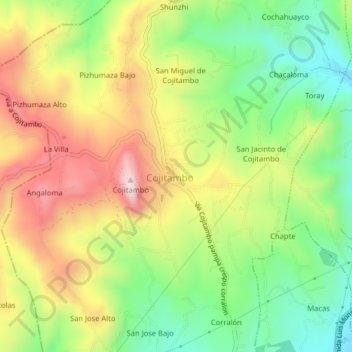
Name: Cojitambo topographic map, elevation, terrain.

Location: Cojitambo, Azogues, Cañar, 030101, Ecuador (-2.77897 -78.90351 -2.73897 -78.86351)

Average elevation: 2,760 m

Minimum elevation: 2,515 m

Maximum elevation: 3,056 m

Gear up for your next adventure:

🥾Hiking Boots - Sturdy boots providing ankle support and traction on rugged trails
🦌Outdoor Trail Camera - Monitor wildlife activity near your favorite spots
🦟Insect Repellent - Keep mosquitoes and black flies away in wooded areas
🧼Travel Hand Sanitizer - Keep hands clean when water is scarce
🔋Lithium AA Batteries - Long-lasting power that performs in extreme cold

As an Amazon Associate, this site earns from qualifying purchases at no extra cost to you.