Geolocate

Grabag topographic map

Click on the map to display elevation.

About this map

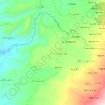
Name: Grabag topographic map, elevation, terrain.

Location: Grabag, Magelang, Central Java, Indonesia (-7.41735 110.30970 -7.37735 110.34970)

Average elevation: 739 m

Minimum elevation: 588 m

Maximum elevation: 990 m

Gear up for your next adventure:

🧥Waterproof Hiking Jacket - Protect yourself from rain and wind while hiking
🧭GPS Handheld Device - Reliable GPS navigation for outdoor adventures
🚲Heavy Duty Bike Lock - Secure your bike at the trailhead or during stops
🥾Approach Shoes - Shoes designed for climbing approaches and rugged trails
Family Camping Tent - Spacious tent suitable for family camping trips

As an Amazon Associate, this site earns from qualifying purchases at no extra cost to you.