Geolocate

Agumbe topographic map

Click on the map to display elevation.

About this map

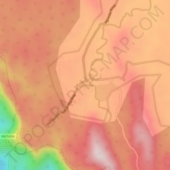
Name: Agumbe topographic map, elevation, terrain.

Location: Agumbe, Tirthahalli taluk, Shimoga, Karnataka, 577411, India (13.48848 75.07626 13.52848 75.11626)

Average elevation: 642 m

Minimum elevation: 214 m

Maximum elevation: 832 m

Gear up for your next adventure:

🥾Waterproof Trail Shoes - Shoes designed to handle wet terrain
🧥Ultralight Puffy Jacket - Maximum warmth that packs down to the size of an orange
🥾Mountain Hiking Boots - High-traction boots for rocky terrain
🥾Trail Hiking Boots - Supportive boots for rough trails
🧥Softshell Jacket - Windproof and breathable jacket for hiking

As an Amazon Associate, this site earns from qualifying purchases at no extra cost to you.