Geolocate

Batal topographic map

Click on the map to display elevation.

About this map

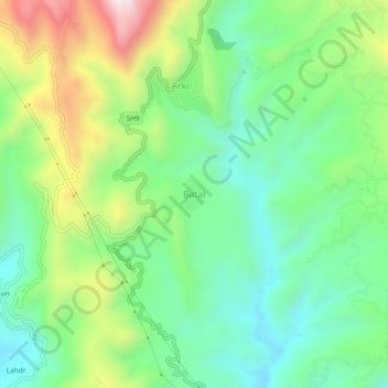
Name: Batal topographic map, elevation, terrain.

Location: Batal, Arki, Solan District, Himachal Pradesh, 173208, India (31.12108 76.94889 31.16108 76.98889)

Average elevation: 1,122 m

Minimum elevation: 894 m

Maximum elevation: 1,568 m

Gear up for your next adventure:

🚲MTB Frame Bag - Carry tools and maps directly on your bicycle frame
🔦LED Flashlight - Powerful and long-lasting flashlight for camping and emergencies
🧴First Aid Kit - Essential first aid supplies for outdoor emergencies
🔦UV Flashlight - Detect minerals or specific insects in the dark
🛁Quick-Dry Microfiber Towel - Space-saving towel that dries rapidly on the move

As an Amazon Associate, this site earns from qualifying purchases at no extra cost to you.