

Denton topographic map
Click on the map to display elevation.
Denton
Denton is located on the northern edge of the Dallas–Fort Worth metropolitan area. These three cities form the area known as the "Golden Triangle of North Texas". According to the United States Census Bureau, the city has a total area of 89.316 square miles (231.33 km2), of which 87.952 square miles (227.79 km2) is land and 1.364 square miles (3.53 km2) is covered by water. The city lies in the northeast edge of the Bend Arch–Fort Worth Basin, which is characterized by flat terrain. Elevation ranges from 500 to 900 feet (150 to 270 m). Part of the city is located atop the Barnett Shale, a geological formation believed to contain large quantities of natural gas. Lewisville Lake, a man-made reservoir, is located 15 miles (24 km) south of the city.
About this map
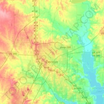
Name: Denton topographic map, elevation, terrain.
Location: Denton, Denton County, Texas, United States (33.11688 -97.26664 33.35831 -97.02381)
Average elevation: 195 m
Minimum elevation: 155 m
Maximum elevation: 255 m