Geolocate

Lake Bled topographic map

Click on the map to display elevation.

About this map

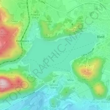
Name: Lake Bled topographic map, elevation, terrain.

Location: Lake Bled, Selo pri Bledu, Bled, Slovenia (46.35828 14.08194 46.36953 14.10855)

Average elevation: 514 m

Minimum elevation: 423 m

Maximum elevation: 736 m

Gear up for your next adventure:

🧰Multitool Knife - Compact and versatile tool for outdoor use
🥾Mountaineering Boots - Supportive boots for climbing and high-altitude hiking
🧢Beanie Hat - Keep your head warm in cold weather
🪑Insulated Seat Pad - Protect your seat from cold rocks and wet logs
🔭Compact Monocular - One-handed bird watching and trail spotting

As an Amazon Associate, this site earns from qualifying purchases at no extra cost to you.