Geolocate

Pachamama topographic map

Click on the map to display elevation.

About this map

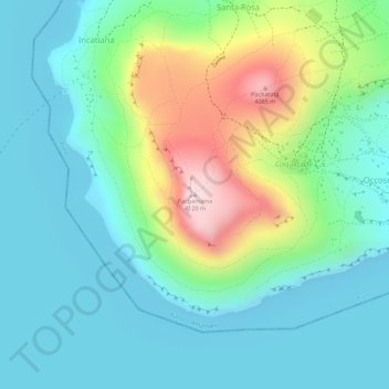
Name: Pachamama topographic map, elevation, terrain.

Location: Pachamama, Amantaní, Puno, Perú (-15.67254 -69.71713 -15.67244 -69.71703)

Average elevation: 3,899 m

Minimum elevation: 3,805 m

Maximum elevation: 4,135 m

Other topographic maps

Click on a map to view its topography, its elevation and its terrain.

Taquile

Perú > Puno > Amantaní

Average elevation: 3,829 m

Gear up for your next adventure:

Bushcraft Tarp - Versatile emergency shelter or gear protection
Camping Coffee Maker - Brew fresh coffee anywhere on the topographic map
🧴Bear Spray Holster - Quick-access carry for essential Canadian wilderness safety
Camping Tent - Weather-resistant tents suitable for 2 to 6 people
💧Filtered Water Bottle - Safe drinking water on the go

As an Amazon Associate, this site earns from qualifying purchases at no extra cost to you.