Geolocate

Chemre topographic map

Click on the map to display elevation.

About this map

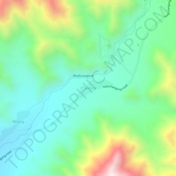
Name: Chemre topographic map, elevation, terrain.

Location: Chemre, Leh Tehsil, Leh district, Ladakh, India (33.92955 77.76342 33.96955 77.80342)

Average elevation: 3,711 m

Minimum elevation: 3,439 m

Maximum elevation: 4,357 m

Gear up for your next adventure:

🧦Hiking Socks - Moisture-wicking and comfortable socks for long hikes
Family Camping Tent - Spacious tent suitable for family camping trips
🛶Canoe Life Vest - Safety vest for water sports
🧰Survival Kit - Essential gear for emergencies in the wilderness
🍽️Titanium Camping Spork - Ultralight and indestructible eating utensil

As an Amazon Associate, this site earns from qualifying purchases at no extra cost to you.