
Bomal topographic map
Interactive map
Click on the map to display elevation.
About this map
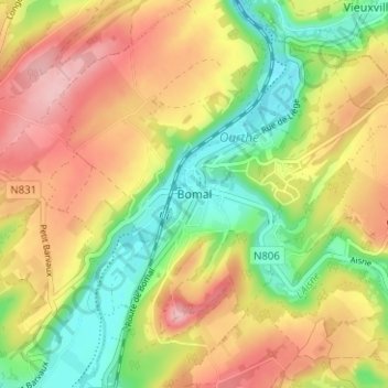
Name: Bomal topographic map, elevation, terrain.
Location: Bomal, Luxemburg, Wallonië, België (50.35601 5.50238 50.39601 5.54238)
Average elevation: 202 m
Minimum elevation: 123 m
Maximum elevation: 281 m
Other topographic maps
Click on a map to view its topography, its elevation and its terrain.