
Thank you for supporting this site ❤️
Make a donation
Make a donation
Gear up for your next adventure:
As an Amazon Associate, this site earns from qualifying purchases at no extra cost to you.
Chagos topographic map
Click on the map to display elevation.
Thank you for supporting this site ❤️
Make a donation
Make a donation
Gear up for your next adventure:
As an Amazon Associate, this site earns from qualifying purchases at no extra cost to you.
About this map
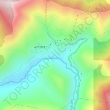
Name: Chagos topographic map, elevation, terrain.
Location: Chagos, La Vilieḷḷa, Ḷḷarón, Cangas del Narcea, 33811, Spain (42.97459 -6.64208 42.99459 -6.62208)
Average elevation: 958 m
Minimum elevation: 658 m
Maximum elevation: 1,448 m
Thank you for supporting this site ❤️
Make a donation
Make a donation
Gear up for your next adventure:
As an Amazon Associate, this site earns from qualifying purchases at no extra cost to you.