
Twin Lakes topographic map
Click on the map to display elevation.
About this map
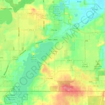
Name: Twin Lakes topographic map, elevation, terrain.
Location: Twin Lakes, Kenosha County, Wisconsin, United States (42.49480 -88.29498 42.54984 -88.19408)
Average elevation: 258 m
Minimum elevation: 226 m
Maximum elevation: 302 m
Other topographic maps
Click on a map to view its topography, its elevation and its terrain.
Pleasant Prairie
United States > Wisconsin > Kenosha County > Pleasant Prairie
Average elevation: 218 m