
Thank you for supporting this site ❤️
Make a donation
Make a donation
Gear up for your next adventure:
As an Amazon Associate, this site earns from qualifying purchases at no extra cost to you.
Padron topographic map
Click on the map to display elevation.
Thank you for supporting this site ❤️
Make a donation
Make a donation
Gear up for your next adventure:
As an Amazon Associate, this site earns from qualifying purchases at no extra cost to you.
About this map
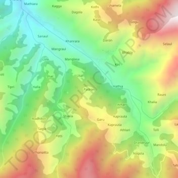
Name: Padron topographic map, elevation, terrain.
Location: Padron, Chamba, Chamba District, Himachal Pradesh, Inde (32.54806 76.22424 32.58806 76.26424)
Average elevation: 1,817 m
Minimum elevation: 1,245 m
Maximum elevation: 2,566 m
Thank you for supporting this site ❤️
Make a donation
Make a donation
Gear up for your next adventure:
As an Amazon Associate, this site earns from qualifying purchases at no extra cost to you.