
Thank you for supporting this site ❤️
Make a donation
Make a donation
Gear up for your next adventure:
As an Amazon Associate, this site earns from qualifying purchases at no extra cost to you.
Fermentões topographic map
Click on the map to display elevation.
Thank you for supporting this site ❤️
Make a donation
Make a donation
Gear up for your next adventure:
As an Amazon Associate, this site earns from qualifying purchases at no extra cost to you.
About this map
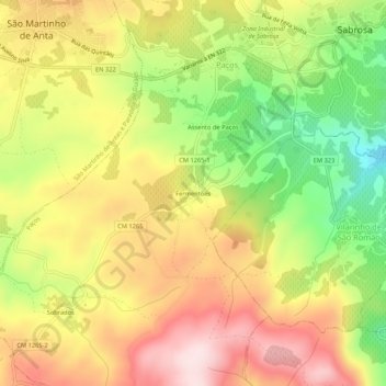
Name: Fermentões topographic map, elevation, terrain.
Location: Fermentões, Paços, Sabrosa, Vila Real, 5060-424, Portugal (41.22939 -7.61808 41.26939 -7.57808)
Average elevation: 635 m
Minimum elevation: 443 m
Maximum elevation: 804 m
Thank you for supporting this site ❤️
Make a donation
Make a donation
Gear up for your next adventure:
As an Amazon Associate, this site earns from qualifying purchases at no extra cost to you.