
Thank you for supporting this site ❤️
Make a donation
Make a donation
Gear up for your next adventure:
As an Amazon Associate, this site earns from qualifying purchases at no extra cost to you.
Talhada topographic map
Click on the map to display elevation.
Thank you for supporting this site ❤️
Make a donation
Make a donation
Gear up for your next adventure:
As an Amazon Associate, this site earns from qualifying purchases at no extra cost to you.
About this map
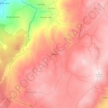
Name: Talhada topographic map, elevation, terrain.
Location: Talhada, Ovadas e Panchora, Resende, Viseu, Portugal (41.00959 -7.97586 41.04959 -7.93586)
Average elevation: 1,033 m
Minimum elevation: 579 m
Maximum elevation: 1,210 m
Thank you for supporting this site ❤️
Make a donation
Make a donation
Gear up for your next adventure:
As an Amazon Associate, this site earns from qualifying purchases at no extra cost to you.