Geolocate

Pochutla topographic map

Click on the map to display elevation.

About this map

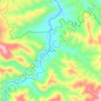
Name: Pochutla topographic map, elevation, terrain.

Location: Pochutla, Ahuacuotzingo, Guerrero, Mexico (17.64056 -98.91778 17.68056 -98.87778)

Average elevation: 1,284 m

Minimum elevation: 1,127 m

Maximum elevation: 1,521 m

Gear up for your next adventure:

🛶Canoe Life Vest - Safety vest for water sports
🧰Emergency Multi-Tool - Compact multi-tool for outdoor survival
🎒Fully Waterproof Backpack - Total protection for photography gear and electronics
🥾Trekking Boots - Durable boots for long-distance trekking
🥾Mountaineering Boots - Supportive boots for climbing and high-altitude hiking

As an Amazon Associate, this site earns from qualifying purchases at no extra cost to you.