
La Valette topographic map
Interactive map
Click on the map to display elevation.
About this map
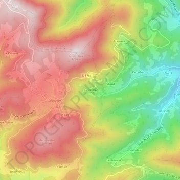
Name: La Valette topographic map, elevation, terrain.
Average elevation: 972 m
Minimum elevation: 621 m
Maximum elevation: 1,244 m
Other topographic maps
Click on a map to view its topography, its elevation and its terrain.
Le Crouzet
France > Auvergne-Rhône-Alpes > Ardèche > Lalouvesc
Le Crouzet, Lalouvesc, Tournon-sur-Rhône, Ardèche, Auvergne-Rhône-Alpes, France métropolitaine, 07520, France
Average elevation: 1,074 m