Geolocate

Castelluccio topographic map

Click on the map to display elevation.

About this map

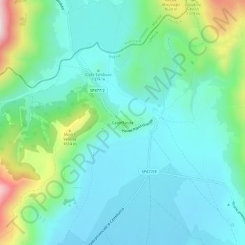
Name: Castelluccio topographic map, elevation, terrain.

Location: Castelluccio, Norcia, Perugia, Umbria, 06046, Italy (42.80878 13.18765 42.84878 13.22765)

Average elevation: 1,409 m

Minimum elevation: 1,281 m

Maximum elevation: 1,848 m

Gear up for your next adventure:

🔋Solar Power Bank - Keep your GPS and devices charged during long outdoor trips
🧰Survival Kit - Essential gear for emergencies in the wilderness
🧢Outdoor Visor - Breathable visor for sunny hikes
🛌Insulated Sleeping Pad - Critical thermal barrier between you and the cold ground
Camping Tent - Weather-resistant tents suitable for 2 to 6 people

As an Amazon Associate, this site earns from qualifying purchases at no extra cost to you.