Geolocate

Aikawa topographic map

Click on the map to display elevation.

About this map

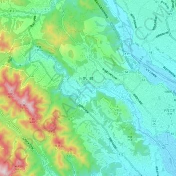
Name: Aikawa topographic map, elevation, terrain.

Location: Aikawa, Aiko County, Kanagawa Prefecture, Japan (35.49825 139.24551 35.55661 139.35466)

Average elevation: 206 m

Minimum elevation: 37 m

Maximum elevation: 715 m

Gear up for your next adventure:

🧼Travel Hand Sanitizer - Keep hands clean when water is scarce
🧳Compression Sacks - Maximize space in your backpack by shrinking gear
🥾Trekking Poles - Adjustable trekking poles to reduce knee stress and improve stability
🥾Hiking Shoes - Durable and comfortable shoes for trail hiking
🛶Kayak Dry Bag - Waterproof storage for kayaking adventures

As an Amazon Associate, this site earns from qualifying purchases at no extra cost to you.