Geolocate

Cahil topographic map

Click on the map to display elevation.

About this map

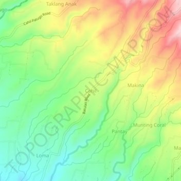
Name: Cahil topographic map, elevation, terrain.

Location: Cahil, Calaca, Batangas, Calabarzon, Philippines (13.96648 120.78592 14.00648 120.82592)

Average elevation: 177 m

Minimum elevation: 68 m

Maximum elevation: 323 m

Other topographic maps

Click on a map to view its topography, its elevation and its terrain.

Dacanlao River

Philippines > Batangas > Calaca

Average elevation: 79 m

Gear up for your next adventure:

🥾Hiking Shorts - Breathable shorts suitable for summer hikes
🧥Softshell Jacket - Windproof and breathable jacket for hiking
🦯Trekking Poles - Reduced impact on joints for steep topographic climbs
🩹Moleskin Blister Pads - Direct protection for painful foot pressure points
🛏️Sleeping Bag - Warm and compact sleeping bags for outdoor camping

As an Amazon Associate, this site earns from qualifying purchases at no extra cost to you.