Geolocate

La Flora topographic map

Click on the map to display elevation.

About this map

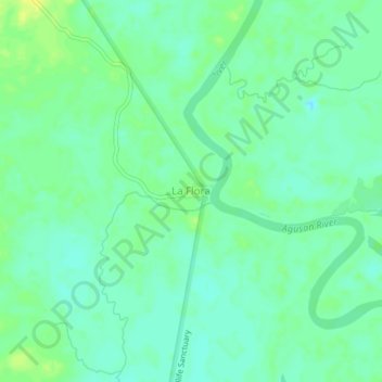
Name: La Flora topographic map, elevation, terrain.

Location: La Flora, Talacogon, Agusan del Sur, Caraga, 8510, Philippines (8.37496 125.79687 8.41496 125.83687)

Average elevation: 15 m

Minimum elevation: 7 m

Maximum elevation: 26 m

Gear up for your next adventure:

🔦LED Flashlight - Powerful and long-lasting flashlight for camping and emergencies
🏕️Camping Hammock - Integrated protection for sleeping between trees
🔦UV Flashlight - Detect minerals or specific insects in the dark
🏃Hydration Running Vest - Carry water and maps close to your body for speed
🩹Moleskin Blister Pads - Direct protection for painful foot pressure points

As an Amazon Associate, this site earns from qualifying purchases at no extra cost to you.