Geolocate

Caral topographic map

Click on the map to display elevation.

About this map

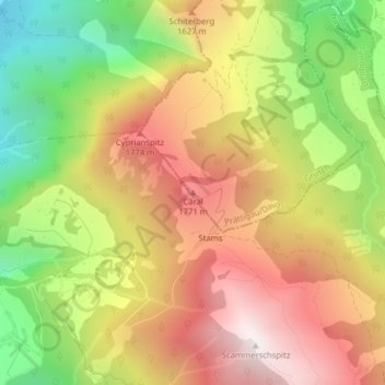
Name: Caral topographic map, elevation, terrain.

Location: Caral, Grüsch, Prättigau/Davos, Grisons, 7202, Switzerland (46.91715 9.60080 46.91725 9.60090)

Average elevation: 1,412 m

Minimum elevation: 755 m

Maximum elevation: 2,004 m

Gear up for your next adventure:

🦯Trekking Poles - Reduced impact on joints for steep topographic climbs
🥾Approach Boots - Comfortable boots for hiking and climbing approaches
🥾Lightweight Hiking Boots - Boots for comfort and mobility on long hikes
🧰Multitool Knife - Compact and versatile tool for outdoor use
🛌Insulated Sleeping Pad - Critical thermal barrier between you and the cold ground

As an Amazon Associate, this site earns from qualifying purchases at no extra cost to you.