Geolocate

Borgata Rodetti topographic map

Click on the map to display elevation.

About this map

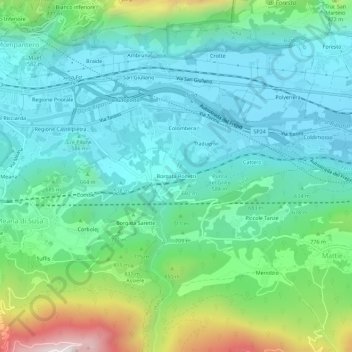
Name: Borgata Rodetti topographic map, elevation, terrain.

Location: Borgata Rodetti, Meana di Susa, Torino, Piedmont, 10050, Italy (45.10711 7.06993 45.14711 7.10993)

Average elevation: 660 m

Minimum elevation: 446 m

Maximum elevation: 1,344 m

Gear up for your next adventure:

🧥Softshell Jacket - Windproof and breathable jacket for hiking
Tent Footprint - Protect tent floor and increase durability
🧶550 Survival Paracord - Versatile utility cord for emergency repairs and rigging
🛏️Camping Sleeping Mat - Comfortable mats for sleeping outdoors
🧼Biodegradable Camp Soap - Environmentally friendly cleaning for gear and body

As an Amazon Associate, this site earns from qualifying purchases at no extra cost to you.