Geolocate

Pachachaca topographic map

Click on the map to display elevation.

About this map

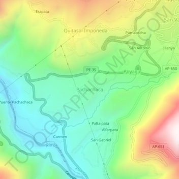
Name: Pachachaca topographic map, elevation, terrain.

Location: Pachachaca, Abancay, Apurímac, Perú (-13.68008 -72.93931 -13.64008 -72.89931)

Average elevation: 2,085 m

Minimum elevation: 1,686 m

Maximum elevation: 2,804 m

Gear up for your next adventure:

🥾Approach Shoes - Shoes designed for climbing approaches and rugged trails
🏃Hydration Running Vest - Carry water and maps close to your body for speed
🛏️Sleeping Bag - Warm and compact sleeping bags for outdoor camping
🛶Canoe Life Vest - Safety vest for water sports
🛌Insulated Sleeping Pad - Critical thermal barrier between you and the cold ground

As an Amazon Associate, this site earns from qualifying purchases at no extra cost to you.