Geolocate

Bangga topographic map

Click on the map to display elevation.

About this map

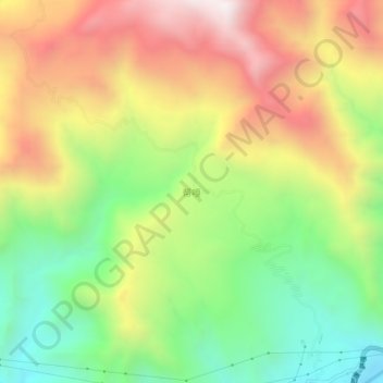
Name: Bangga topographic map, elevation, terrain.

Location: Bangga, Chamdo City, Tibet, China (30.66566 97.54452 30.70566 97.58452)

Average elevation: 3,685 m

Minimum elevation: 3,167 m

Maximum elevation: 4,284 m

Gear up for your next adventure:

🧥Waterproof Hiking Jacket - Protect yourself from rain and wind while hiking
🥾Waterproof Hiking Boots - Boots keeping your feet dry in wet conditions
Lightweight Camping Tent - Portable shelter optimized for Canadian backcountry camping
🥾All-Terrain Hiking Boots - Versatile boots for varied hiking conditions
🐕Hiking Dog Pack - Let your canine companion carry their own water and food

As an Amazon Associate, this site earns from qualifying purchases at no extra cost to you.