Geolocate

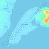
Talabaan topographic map

Click on the map to display elevation.

About this map

Name: Talabaan topographic map, elevation, terrain.

Location: Talabaan, Zamboanga City, Zamboanga Peninsula, 7000, Philippines (6.93661 122.15531 6.97661 122.19531)

Average elevation: 5 m

Minimum elevation: -1 m

Maximum elevation: 21 m

Other topographic maps

Click on a map to view its topography, its elevation and its terrain.

Sacol Island

Philippines > Zamboanga City

Average elevation: 6 m

Vitali River

Philippines > Zamboanga City > Mangusu

Average elevation: 27 m

Sinunug Island

Philippines > Zamboanga City

Average elevation: 0 m

Plaza Pershing

Philippines > Zamboanga City

Average elevation: 4 m

Gear up for your next adventure:

🧥Fleece Jacket - Warm and lightweight jacket for layering
🧰Multitool Knife - Compact and versatile tool for outdoor use
🧭GPS Outdoor Watch - Smart watch for navigation and fitness tracking in nature
🧭Orienteering Kit - Tools for map reading and navigation in the wild
👟Leg Gaiters - Keep debris, mud, and snow out of your boots

As an Amazon Associate, this site earns from qualifying purchases at no extra cost to you.