Geolocate

Chasquitambo topographic map

Click on the map to display elevation.

About this map

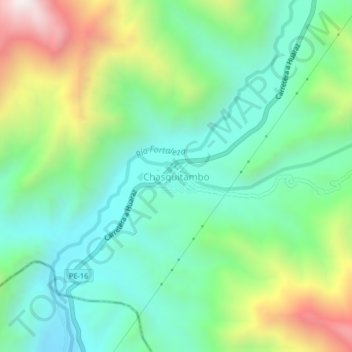
Name: Chasquitambo topographic map, elevation, terrain.

Location: Chasquitambo, Colquioc, Bolognesi, Áncash, Perú (-10.33236 -77.63486 -10.29236 -77.59486)

Average elevation: 967 m

Minimum elevation: 631 m

Maximum elevation: 1,710 m

Gear up for your next adventure:

Camping Groundsheet - Protect your tent from moisture and dirt
🧤Thermal Hiking Gloves - Grip-enhanced gloves for cold-weather altitude trekking
🕶️Polarized Sunglasses - Protect your eyes with durable polarized lenses
🗺️Topographic Maps - Detailed maps to explore trails, mountains, and wilderness areas
🧭GPS Tracker - Track your location in remote areas safely

As an Amazon Associate, this site earns from qualifying purchases at no extra cost to you.