
Thank you for supporting this site ❤️
Make a donation
Make a donation
Gear up for your next adventure:
As an Amazon Associate, this site earns from qualifying purchases at no extra cost to you.
Frattura topographic map
Click on the map to display elevation.
Thank you for supporting this site ❤️
Make a donation
Make a donation
Gear up for your next adventure:
As an Amazon Associate, this site earns from qualifying purchases at no extra cost to you.
About this map
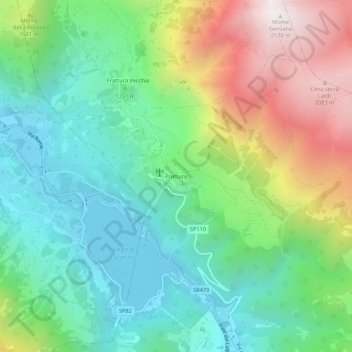
Name: Frattura topographic map, elevation, terrain.
Location: Frattura, Scanno, L'Aquila, Abruzzo, 67038, Italia (41.90983 13.85151 41.94983 13.89151)
Average elevation: 1,334 m
Minimum elevation: 912 m
Maximum elevation: 2,163 m
Thank you for supporting this site ❤️
Make a donation
Make a donation
Gear up for your next adventure:
As an Amazon Associate, this site earns from qualifying purchases at no extra cost to you.