Geolocate

Mount Gilboa topographic map

Click on the map to display elevation.

About this map

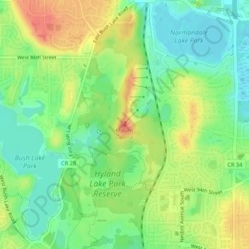
Name: Mount Gilboa topographic map, elevation, terrain.

Location: Mount Gilboa, Bloomington, Hennepin County, Minnesota, 55438, United States (44.84018 -93.36721 44.84028 -93.36711)

Average elevation: 268 m

Minimum elevation: 241 m

Maximum elevation: 303 m

Other topographic maps

Click on a map to view its topography, its elevation and its terrain.

Gear up for your next adventure:

🛰️Satellite Messenger - Emergency communication for areas with no cell service
🥾Approach Boots - Comfortable boots for hiking and climbing approaches
🔥Emergency Fire Starter - Reliable ignition source for all weather conditions
🧢Sun Protection Cap - Breathable cap to protect from sun exposure
🪑Insulated Seat Pad - Protect your seat from cold rocks and wet logs

As an Amazon Associate, this site earns from qualifying purchases at no extra cost to you.