Geolocate

Hastings topographic map

Click on the map to display elevation.

About this map

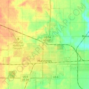
Name: Hastings topographic map, elevation, terrain.

Location: Hastings, Adams County, Nebraska, United States (40.56133 -98.46754 40.64467 -98.34537)

Average elevation: 587 m

Minimum elevation: 569 m

Maximum elevation: 604 m

Gear up for your next adventure:

🧊Portable Cooler - Keep food and drinks cold during outdoor adventures
🎒Fully Waterproof Backpack - Total protection for photography gear and electronics
Camping Coffee Maker - Brew fresh coffee anywhere on the topographic map
🗺️Topographic Maps - Detailed maps to explore trails, mountains, and wilderness areas
🧴Insect Repellent - Protect yourself from bugs during outdoor adventures

As an Amazon Associate, this site earns from qualifying purchases at no extra cost to you.