
Thank you for supporting this site ❤️
Make a donation
Make a donation
Gear up for your next adventure:
As an Amazon Associate, this site earns from qualifying purchases at no extra cost to you.
Gestalgar topographic map
Click on the map to display elevation.
Thank you for supporting this site ❤️
Make a donation
Make a donation
Gear up for your next adventure:
As an Amazon Associate, this site earns from qualifying purchases at no extra cost to you.
About this map
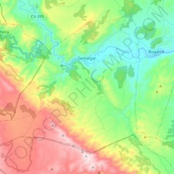
Name: Gestalgar topographic map, elevation, terrain.
Location: Gestalgar, La Serranía, Valencia, 46166, Spanje (39.53824 -0.93602 39.63266 -0.78951)
Average elevation: 485 m
Minimum elevation: 156 m
Maximum elevation: 1,041 m
Thank you for supporting this site ❤️
Make a donation
Make a donation
Gear up for your next adventure:
As an Amazon Associate, this site earns from qualifying purchases at no extra cost to you.