Geolocate

Marbel topographic map

Click on the map to display elevation.

About this map

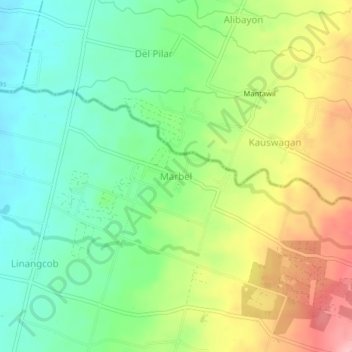
Name: Marbel topographic map, elevation, terrain.

Location: Marbel, Kidapawan, Cotabato, Soccsksargen, 9404, Philippines (7.06173 125.06715 7.10173 125.10715)

Average elevation: 223 m

Minimum elevation: 165 m

Maximum elevation: 312 m

Other topographic maps

Click on a map to view its topography, its elevation and its terrain.

Pulangi River

Philippines > Cotabato > Kidapawan

Average elevation: 440 m

Gear up for your next adventure:

🧦Merino Wool Socks - Moisture-wicking comfort for long-distance hiking
🧴Bear Spray Holster - Quick-access carry for essential Canadian wilderness safety
📷Outdoor Action Camera - Capture high-elevation views and rugged adventures
🧤Thermal Hiking Gloves - Grip-enhanced gloves for cold-weather altitude trekking
🥾Waterproof Hiking Boots - Essential footwear for rugged terrain and wet Canadian trails

As an Amazon Associate, this site earns from qualifying purchases at no extra cost to you.