Geolocate

Audierne topographic map

Click on the map to display elevation.

About this map
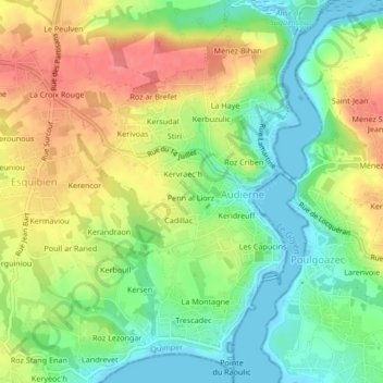
Name: Audierne topographic map, elevation, terrain.

Location: Audierne, Quimper, Finistère, Brittany, Metropolitan France, 29770, France (48.00918 -4.55777 48.03740 -4.53237)

Average elevation: 34 m

Minimum elevation: -3 m

Maximum elevation: 74 m

Other topographic maps

Click on a map to view its topography, its elevation and its terrain.

Les Capucins

France > Brittany > Finistère > Audierne

Average elevation: 31 m

Gear up for your next adventure:

🥾Trekking Boots - Durable boots for long-distance trekking
🥤Collapsible Travel Cup - Saves space and weight in your mess kit
🗺️Topographic Maps - Detailed maps to explore trails, mountains, and wilderness areas
🦶Hiking Shoe Insoles - Added support for high arches and long days on feet
🍽️Titanium Camping Spork - Ultralight and indestructible eating utensil

As an Amazon Associate, this site earns from qualifying purchases at no extra cost to you.