Geolocate

Nameless topographic map

Click on the map to display elevation.

About this map

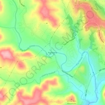
Name: Nameless topographic map, elevation, terrain.

Location: Nameless, Leander, Travis County, Texas, United States (30.50460 -97.94705 30.54460 -97.90705)

Average elevation: 277 m

Minimum elevation: 214 m

Maximum elevation: 352 m

Gear up for your next adventure:

🥾Trail Hiking Boots - Supportive boots for rough trails
🧴First Aid Kit - Essential first aid supplies for outdoor emergencies
🧥Ultralight Puffy Jacket - Maximum warmth that packs down to the size of an orange
🥫Freeze-Dried Meals - Lightweight, high-calorie nutrition for multi-day treks
🔦LED Flashlight - Powerful and long-lasting flashlight for camping and emergencies

As an Amazon Associate, this site earns from qualifying purchases at no extra cost to you.