
Make a donation
Gear up for your next adventure:
As an Amazon Associate, this site earns from qualifying purchases at no extra cost to you.
Langwarden topographic map
Click on the map to display elevation.
Make a donation
Gear up for your next adventure:
As an Amazon Associate, this site earns from qualifying purchases at no extra cost to you.
About this map
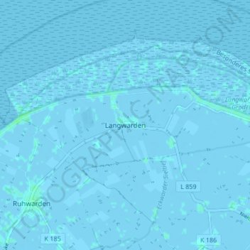
Name: Langwarden topographic map, elevation, terrain.
Average elevation: 0 m
Minimum elevation: -3 m
Maximum elevation: 4 m
Make a donation
Gear up for your next adventure:
As an Amazon Associate, this site earns from qualifying purchases at no extra cost to you.
Other topographic maps
Click on a map to view its topography, its elevation and its terrain.
Mellum
Deutschland > Niedersachsen > Landkreis Wesermarsch > Butjadingen
Als Maßnahme der Bestandslenkung der Silbermöwe wurden Brutvögel getötet. Ihren Höhepunkt erreichte die Silbermöwenbekämpfung im Jahre 1939, als rund 12.000 Eier abgesammelt und 4500 Jung- und 150 Altvögel abgeschossen wurden.
Average elevation: 0 m