Geolocate

Mamali topographic map

Click on the map to display elevation.

About this map

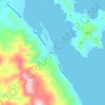
Name: Mamali topographic map, elevation, terrain.

Location: Mamali, Mati, Davao Oriental, Davao Region, 8200, Philippines (6.85852 126.14957 6.89852 126.18957)

Average elevation: 98 m

Minimum elevation: 0 m

Maximum elevation: 430 m

Other topographic maps

Click on a map to view its topography, its elevation and its terrain.

Mayo River

Philippines > Davao Oriental > Mati

Average elevation: 461 m

Gear up for your next adventure:

🔋Emergency Crank Radio - Weather alerts and power without needing batteries
🔭Outdoor Binoculars - Lightweight binoculars for birdwatching and hiking
🔦UV Flashlight - Detect minerals or specific insects in the dark
🦶Hiking Shoe Insoles - Added support for high arches and long days on feet
🧢Hiking Sun Hat - Wide-brimmed protection for exposed mountain ridges

As an Amazon Associate, this site earns from qualifying purchases at no extra cost to you.