Geolocate

Sumer Village topographic map

Click on the map to display elevation.

About this map

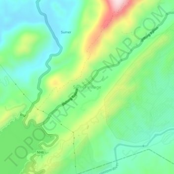
Name: Sumer Village topographic map, elevation, terrain.

Location: Sumer Village, Umsning, Ri-Bhoi, Meghalaya, 793122, India (25.66286 91.89302 25.70286 91.93302)

Average elevation: 971 m

Minimum elevation: 849 m

Maximum elevation: 1,231 m

Gear up for your next adventure:

Backpacking Tent - Lightweight tent for long-distance hiking trips
🔭Outdoor Binoculars - Lightweight binoculars for birdwatching and hiking
🥘Camping Cookware Set - Compact nesting pots and pans for trail cooking
💧Filtered Water Bottle - Safe drinking water on the go
🥾All-Terrain Hiking Boots - Versatile boots for varied hiking conditions

As an Amazon Associate, this site earns from qualifying purchases at no extra cost to you.