
Thank you for supporting this site ❤️
Make a donation
Make a donation
Gear up for your next adventure:
As an Amazon Associate, this site earns from qualifying purchases at no extra cost to you.
Ponte topographic map
Click on the map to display elevation.
Thank you for supporting this site ❤️
Make a donation
Make a donation
Gear up for your next adventure:
As an Amazon Associate, this site earns from qualifying purchases at no extra cost to you.
About this map
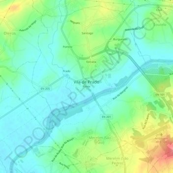
Name: Ponte topographic map, elevation, terrain.
Location: Ponte, Vila de Prado, Vila Verde, Braga, 4730-455, Portugal (41.57811 -8.48524 41.61811 -8.44524)
Average elevation: 42 m
Minimum elevation: 18 m
Maximum elevation: 100 m
Thank you for supporting this site ❤️
Make a donation
Make a donation
Gear up for your next adventure:
As an Amazon Associate, this site earns from qualifying purchases at no extra cost to you.