

La Luz topographic map
Click on the map to display elevation.
La Luz
The largest employer in the surrounding area is Holloman Air Force Base. La Luz itself is largely residential and agricultural in land use but a small market is located on the state maintained road that connects the village to Highway 70. La Luz has long been known for the many fruits that are grown in the area including figs, apricots, plums and peaches. Apples, cherries, and pears are grown in the higher elevations in the canyon areas to the east of the village. The surrounding area also has a number of vineyards and pistachio groves. A number of artists also reside in the area.
About this map
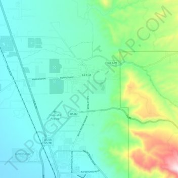
Name: La Luz topographic map, elevation, terrain.
Location: La Luz, Otero County, New Mexico, 88337, United States (32.94534 -105.98488 32.99428 -105.87564)
Average elevation: 1,487 m
Minimum elevation: 1,316 m
Maximum elevation: 2,093 m