Geolocate

Compariès topographic map

Click on the map to display elevation.

About this map
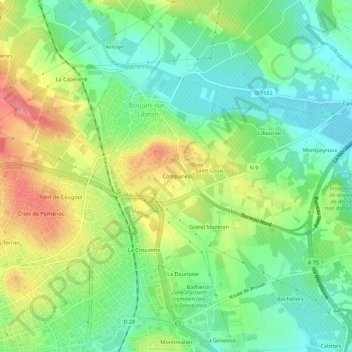
Name: Compariès topographic map, elevation, terrain.

Location: Compariès, Béziers, Hérault, Occitanie, France métropolitaine, 34500, France (43.34443 3.23285 43.38443 3.27285)

Average elevation: 66 m

Minimum elevation: 33 m

Maximum elevation: 115 m

Other topographic maps

Click on a map to view its topography, its elevation and its terrain.

34500

France > Occitanie > Hérault > Béziers

Average elevation: 43 m

Gear up for your next adventure:

📷Outdoor Action Camera - Capture high-elevation views and rugged adventures
🧶550 Survival Paracord - Versatile utility cord for emergency repairs and rigging
🧊Insulated Water Bottle - Keeps drinks cold in summer and prevents freezing in winter
🦶Hiking Shoe Insoles - Added support for high arches and long days on feet
🦯Trekking Poles - Reduced impact on joints for steep topographic climbs

As an Amazon Associate, this site earns from qualifying purchases at no extra cost to you.