Geolocate

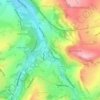
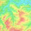
Gomersal topographic map

Click on the map to display elevation.

About this map
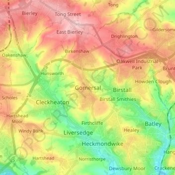
Name: Gomersal topographic map, elevation, terrain.

Location: Gomersal, Kirklees, West Yorkshire, England, BD19 4JR, United Kingdom (53.69303 -1.72677 53.77303 -1.64677)

Average elevation: 133 m

Minimum elevation: 43 m

Maximum elevation: 224 m

Other topographic maps

Click on a map to view its topography, its elevation and its terrain.
Holmfirth Branch

United Kingdom > England > Kirklees > Brockholes

Average elevation: 185 m

Meltham

United Kingdom > England > Kirklees

Average elevation: 278 m

Mirfield

United Kingdom > England > Kirklees > Lower Hopton

Average elevation: 97 m

Denby Dale

United Kingdom > England > Kirklees > Scissett

Average elevation: 168 m

Kirkburton

United Kingdom > England > Kirklees

Average elevation: 148 m

Holme Valley

United Kingdom > England > Kirklees > Holmfirth

Average elevation: 290 m

Greenhead Park

United Kingdom > England > Kirklees > Huddersfield

Average elevation: 119 m

Hey Wood

United Kingdom > England > Kirklees > Farnley Tyas

Average elevation: 186 m

Crow Nest Park

United Kingdom > England > Kirklees > Dewsbury

Average elevation: 64 m

Denby Dale

United Kingdom > England > Kirklees

Average elevation: 187 m

Gear up for your next adventure:

🔦LED Flashlight - Powerful and long-lasting flashlight for camping and emergencies
🎒Backpack Rain Cover - External shield to keep your entire pack dry
🕶️Polarized Sunglasses - Reduces glare from snow and water at high elevations
🧥Thermal Layer - Insulating layer for cold outdoor conditions
🔋Emergency Crank Radio - Weather alerts and power without needing batteries

As an Amazon Associate, this site earns from qualifying purchases at no extra cost to you.