Geolocate

Trinità topographic map

Click on the map to display elevation.

About this map

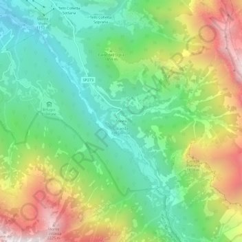
Name: Trinità topographic map, elevation, terrain.

Location: Trinità, Entracque, Cuneo, Piemonte, Italia (44.19486 7.41103 44.23486 7.45103)

Average elevation: 1,406 m

Minimum elevation: 894 m

Maximum elevation: 2,275 m

Other topographic maps

Click on a map to view its topography, its elevation and its terrain.

Valle Gesso di Entraque

Italia > Piemonte > Cuneo > Entracque

Average elevation: 1,256 m

Gear up for your next adventure:

🚲Heavy Duty Bike Lock - Secure your bike at the trailhead or during stops
🦯Trekking Poles - Reduced impact on joints for steep topographic climbs
🎒Backpack Rain Cover - External shield to keep your entire pack dry
🧢Outdoor Cap - Protective cap for sun and rain during hikes
Camping Coffee Maker - Brew fresh coffee anywhere on the topographic map

As an Amazon Associate, this site earns from qualifying purchases at no extra cost to you.