Geolocate

Toturu topographic map

Click on the map to display elevation.

About this map

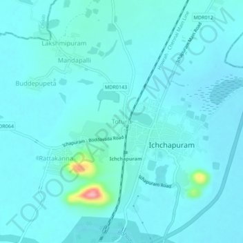
Name: Toturu topographic map, elevation, terrain.

Location: Toturu, Ichchapuram, Srikakulam, Andhra Pradesh, 532312, India (19.09655 84.65995 19.13655 84.69995)

Average elevation: 15 m

Minimum elevation: 1 m

Maximum elevation: 137 m

Gear up for your next adventure:

🥾Hiking Boots - Sturdy boots providing ankle support and traction on rugged trails
🎒Fully Waterproof Backpack - Total protection for photography gear and electronics
🧼Biodegradable Camp Soap - Environmentally friendly cleaning for gear and body
🧢Beanie Hat - Keep your head warm in cold weather
🥾Hiking Gaiters - Protect legs and shoes from mud, snow, and debris

As an Amazon Associate, this site earns from qualifying purchases at no extra cost to you.