
Thank you for supporting this site ❤️
Make a donation
Make a donation
Gear up for your next adventure:
As an Amazon Associate, this site earns from qualifying purchases at no extra cost to you.
Bethelehem topographic map
Click on the map to display elevation.
Thank you for supporting this site ❤️
Make a donation
Make a donation
Gear up for your next adventure:
As an Amazon Associate, this site earns from qualifying purchases at no extra cost to you.
About this map
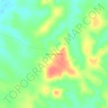
Name: Bethelehem topographic map, elevation, terrain.
Location: Bethelehem, Kabinda, Lomami, Democratic Republic of the Congo (-5.12041 25.82681 -5.08041 25.86681)
Average elevation: 579 m
Minimum elevation: 555 m
Maximum elevation: 613 m
Thank you for supporting this site ❤️
Make a donation
Make a donation
Gear up for your next adventure:
As an Amazon Associate, this site earns from qualifying purchases at no extra cost to you.