
Thank you for supporting this site ❤️
Make a donation
Make a donation
Gear up for your next adventure:
As an Amazon Associate, this site earns from qualifying purchases at no extra cost to you.
Dhiban topographic map
Click on the map to display elevation.
Thank you for supporting this site ❤️
Make a donation
Make a donation
Gear up for your next adventure:
As an Amazon Associate, this site earns from qualifying purchases at no extra cost to you.
About this map
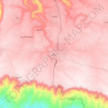
Name: Dhiban topographic map, elevation, terrain.
Location: Dhiban, Dieban Sub-District, Dieban District, Madaba, Jordan (31.45851 35.74009 31.53851 35.82009)
Average elevation: 647 m
Minimum elevation: 107 m
Maximum elevation: 785 m
Thank you for supporting this site ❤️
Make a donation
Make a donation
Gear up for your next adventure:
As an Amazon Associate, this site earns from qualifying purchases at no extra cost to you.