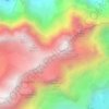
Sool topographic map
Click on the map to display elevation.
Sool
The village of Sool is situated at an elevation of 637 m (2,090 ft) on a prehistoric landslide, betwe the valleys of the Linth and Sernf rivers. The village of Schwanden lies below it, at the confluence of both rivers.
About this map

Name: Sool topographic map, elevation, terrain.
Location: Sool, Glarus Süd, Glarus, 8762, Switzerland (46.98026 9.06551 47.02026 9.10551)
Average elevation: 860 m
Minimum elevation: 492 m
Maximum elevation: 1,954 m
Other topographic maps
Click on a map to view its topography, its elevation and its terrain.