Geolocate

Chavornay topographic map

Click on the map to display elevation.

About this map
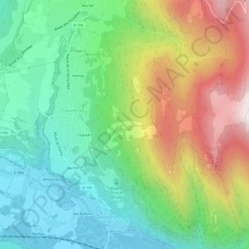
Name: Chavornay topographic map, elevation, terrain.

Location: Chavornay, Arvière-en-Valromey, Belley, Ain, Auvergne-Rhône-Alpes, France métropolitaine, 01260, France (45.86435 5.70036 45.89717 5.75817)

Average elevation: 662 m

Minimum elevation: 227 m

Maximum elevation: 1,439 m

Other topographic maps

Click on a map to view its topography, its elevation and its terrain.

Assin

France > Auvergne-Rhône-Alpes > Ain > Arvière-en-Valromey

Average elevation: 721 m

Gear up for your next adventure:

🎒Hiking Daypack - Lightweight and durable backpacks for day trips and excursions
🦶Hiking Shoe Insoles - Added support for high arches and long days on feet
☕Camping Coffee Maker - Brew fresh coffee anywhere on the topographic map
🧭GPS Handheld Device - Reliable GPS navigation for outdoor adventures
🥾Hiking Shoes - Durable and comfortable shoes for trail hiking

As an Amazon Associate, this site earns from qualifying purchases at no extra cost to you.